Καλάθι
  • Χωρίς απόθεμα
    REVEAL X - ΚΟΚΚΙΝΗ ΘΑΛΑΣΣΑ, ΚΟΛΠΟΣ ΚΑΙ ΝΗΣΙΑ ΚΑΙ ΣΕΫΧΕΛΕΣ

REVEAL X - RED SEA, THE GULF AND SEYCHELLES IS.

263,05 €
με ΦΠΑ
M-ME-T-204-R-MS

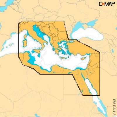
REVEAL X Κόκκινη Θάλασσα, Κόλπος και νησία Σεϋχελών.

Χωρίς απόθεμα
Ποσότητα

Experience the X generation of C-MAP charts – with game-changing Shaded Relief!

C-MAP® REVEAL™ X offers a fresh, dynamic experience. All the great features from DISCOVER X, including all-new Map Inspector Tool, and more – bring the world around you to life with Shaded Relief and feel connected to your surroundings with Satellite Overlay. REVEAL X charts also deliver smooth integration with the Simrad® Companion App and come with 12 months free online updates. Exclusively for Simrad® NSX.

Next Generation Charts A fresh, dynamic chart experience, making navigation clearer than ever before

  • Optimised data and new chart presentation to give you the best on-the-water navigation experience
  • Always see the data you need without clutter, optimised at every zoom level
  • Best-in-class Day & Night modes. Stay safe and navigate with ease, whatever the weather, whatever the time of day


Smooth App Integration

Link to the Simrad® Companion App – enjoy the same charts and a fully connected experience

  • Plan trips, review tracks and plot waypoints on the App, then sync straight to your NSX
  • Access NSX manuals, “How To” guides and much more, directly from the App
  • The future is connected; with C-MAP & Simrad, you’ll be ready


The Best of C-MAP

The latest chart data, with the detail you need to make the most of your time on the water

  • Full-Featured Vector Charts – make navigation easy with accurate, up-to-date vector chart detail from official hydrographic office sources
  • High-Res Bathymetry – identify shallows, drop offs, ledges, holes or humps, with accurate contours down to 1-foot. Includes the best of C-MAP HRB data
  • Subscription-Free Autorouting – Automatically plot the shortest, safest route based on detailed chart data and your vessel information. With C-MAP, Easy Routing is always subscription free
  • Custom Depth Shading – set a clear visual safety depth or create your own shading and level-up your fishing to see things your way
  • Harbor & Approach Details – approach any harbor and inlet with confidence. The perfect conclusion to a long cruise or an exciting day of fishing


Exclusively in REVEAL X:

  • Shaded Relief – bring the world around you to life with 3D rendered land and underwater elevation, including areas of ultra-high resolution – a game-changer for anglers and divers
  • Satellite Overlay – feel better connected to your surroundings when you find yourself in an unfamiliar place

New Map Inspector Tool Quickly access the information you need, with a simple touch of the screen

  • Tides & Currents – detailed projections of water level and tidal data to help you plan your day out
  • Detailed Marina Port Plans – docking in an unfamiliar port is no problem when you have precise layouts of thousands of marinas, including slip spaces, restricted areas, and other vital information

12 Months Free Chart Updates


M-ME-T-204-R-MS
Χωρίς απόθεμα

Μπορεί επίσης να σας αρέσουν

2 ακόμα προϊόντα στην ίδια κατηγορία: